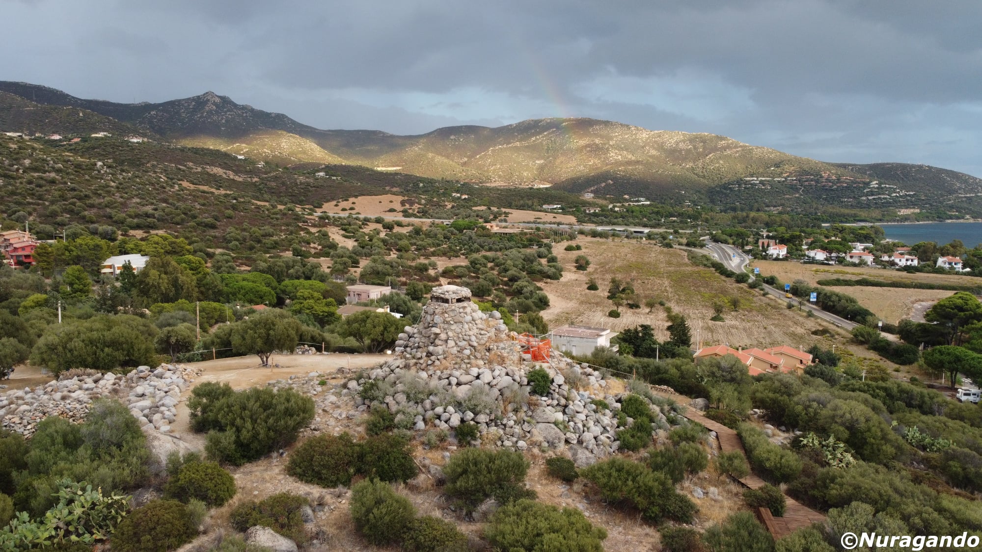
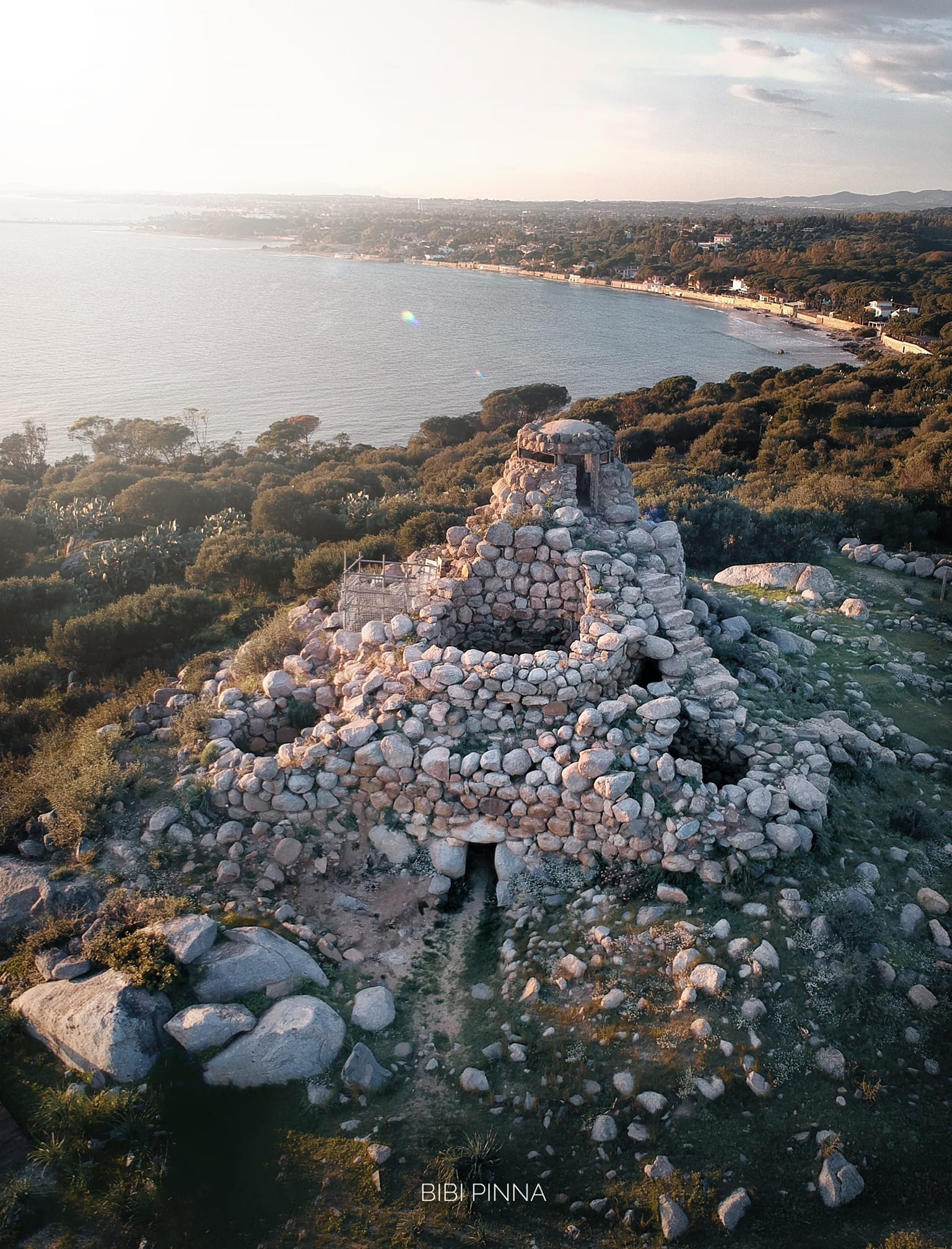
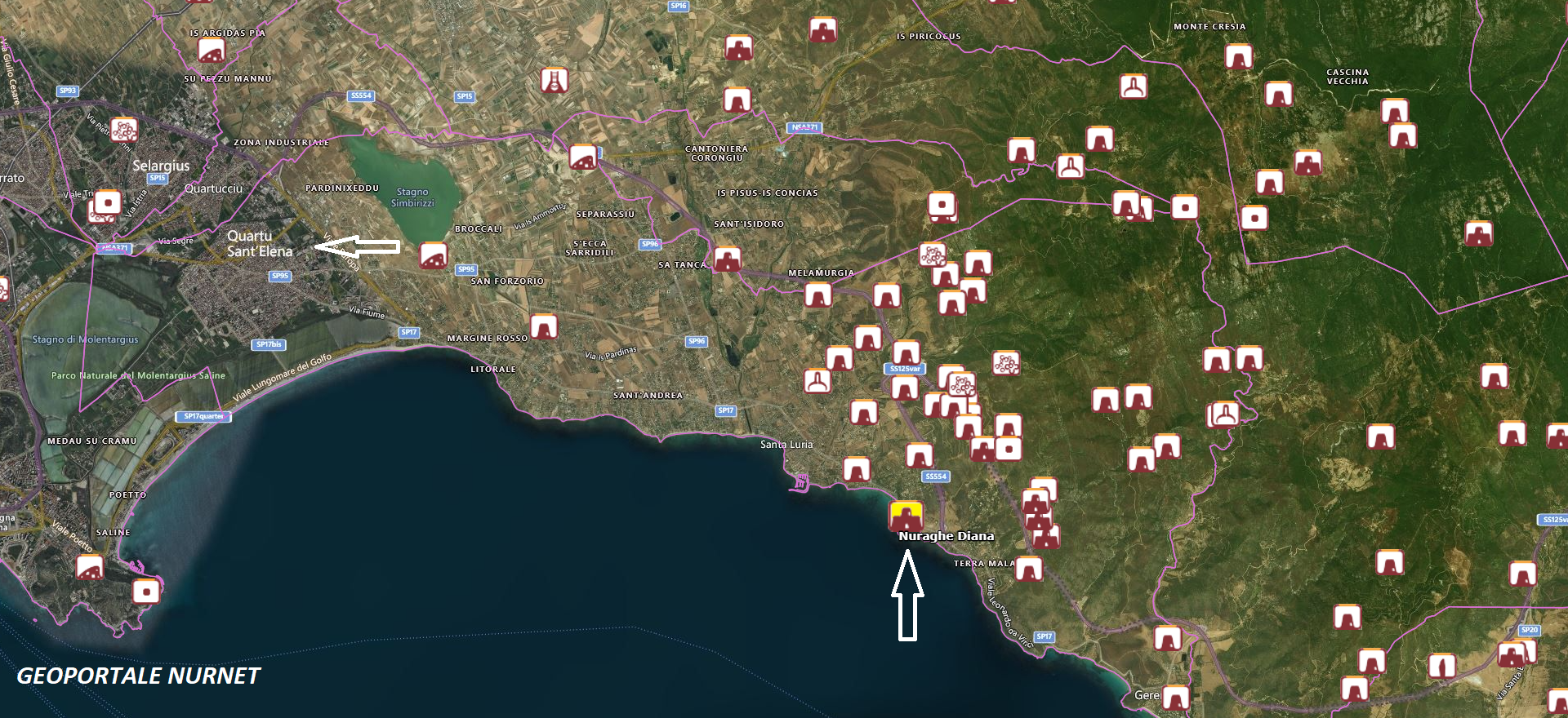
Along the coast of Quartu Sant’Elena, in the locality of Is Mortorius, stands the nuraghe Diana.
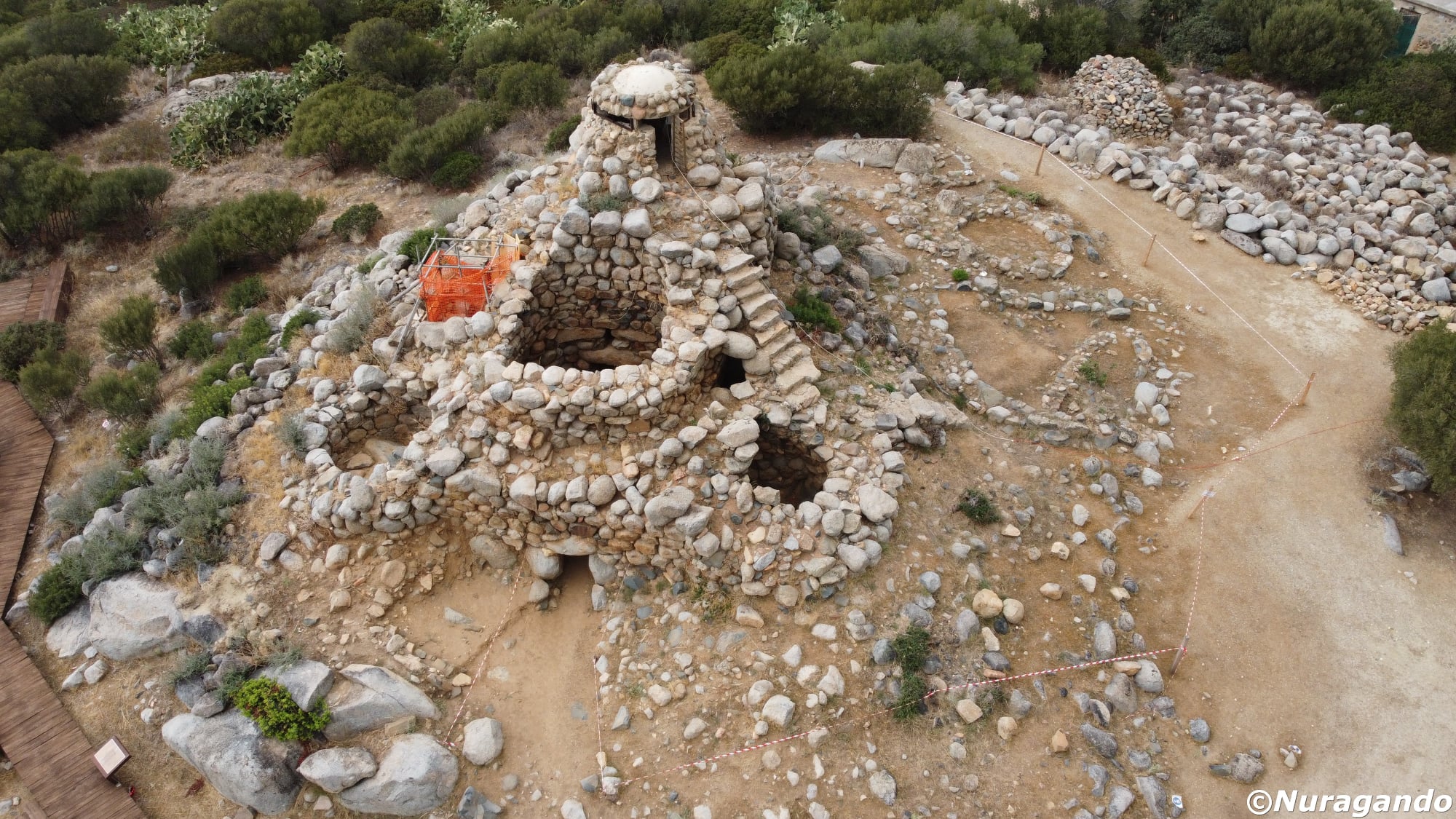
It is a complex poly-lobed nuraghe, which, as noted by Mibact Sardegna, presents “an unconventional construction characteristic: the largest and most difficult stones to lift, which usually form the base of this type of monument, are placed at the top, while three enormous monolithic blocks create the remarkable entrance portal.”
From the volume “La Preistoria del Golfo di Cagliari” (2007), the following excerpts are taken in which the author, archaeologist Enrico Atzeni, briefly describes the monument and the surrounding area:
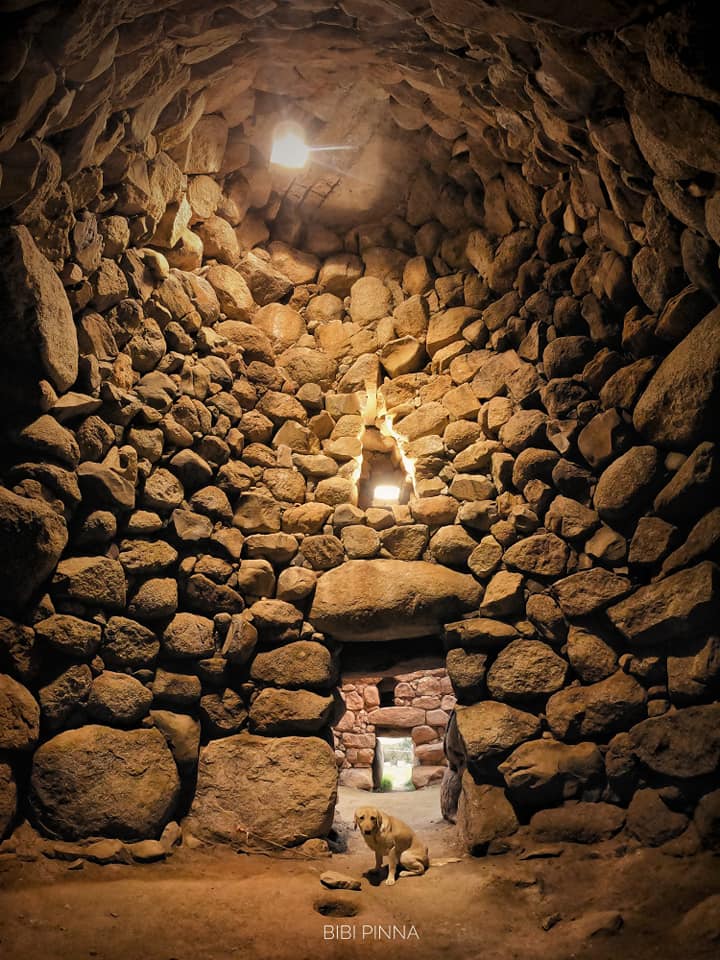
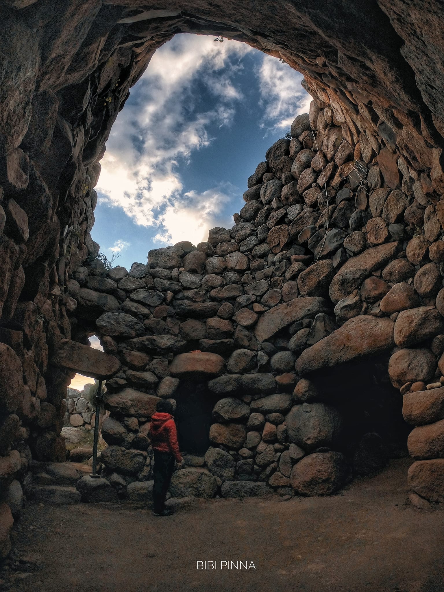
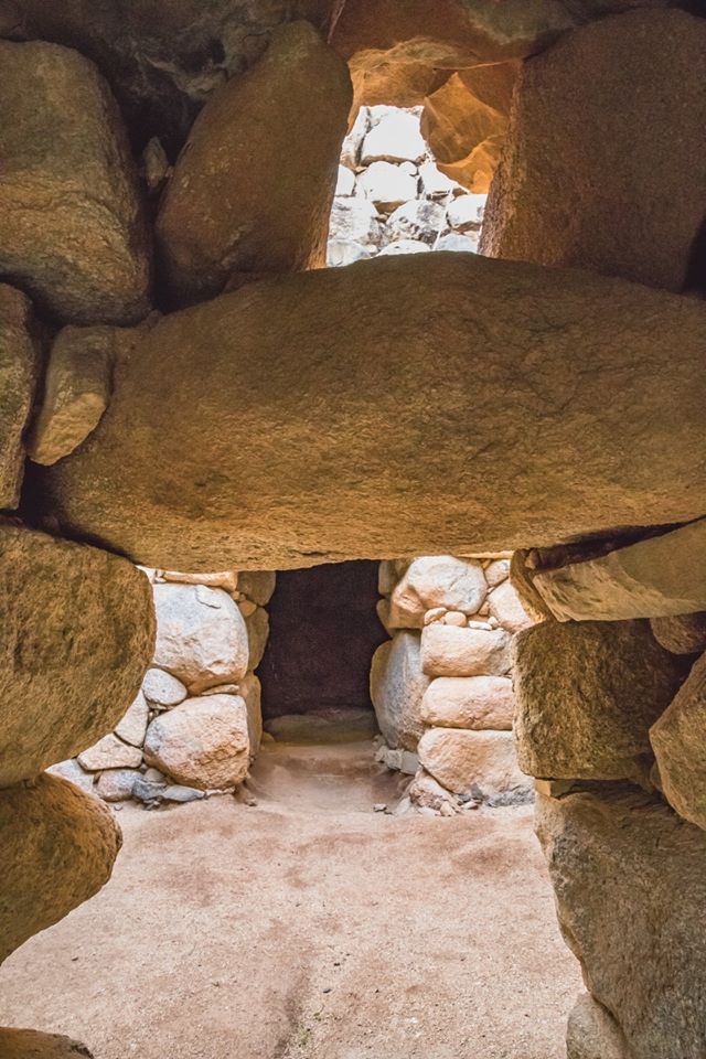
“Along the coastal nuragic ‘limes’ that controls the rocky eastern arc of the Gulf of Quartu Sant’Elena, the Nuraghe Diana of ‘Is Mortorius’ dominates the homonymous promontory and the two nearby, sheltered sandy bays of easy maritime landing. Within the Military Domain, the archaeological area was occupied, during World War II, by the war and logistics facilities of Battery ‘C.Faldi,’ and for emergencies at an altitude of m. 35 on the surrounding granite chaos, had a concrete fortification for observation on the cyclopean ruins, accessible from the ground level via a steep stepped ramp on the east side. The first reports and surveys of the monument date back to the 1950s, in its strategic position controlling the nuragic routes of the gulf…” “… Freed, with the crane, from the massive pyramid of collapses that concealed them, externally up to a prudent base containment ring and internally up to the clearance of the spaces at the level of the last uses, the remains of the ancient building now mostly re-emerge, following the pattern of a multiple nuraghe ‘a tancato’, yet in a harmonious, more coherent and united architectural formula, in contrast to the more frequent technique of the building body – mono-bicellular – as a secondary addition to the primitive Mastio. Today, one can appreciate, on the balanced symmetry of an equilateral triangle, the articulated development of curtains and towers symmetrically centered on a semi-open courtyard of sub-quadrangular plan, disengaging the main access from the outside, along a corridor with crosswise galleys, the passage to the three vaulted towers ‘tholos,’ access to the still unexplored rooms obtained on the West curtain and, through unique staircases, on the East and South-East curtains. Although strongly degraded in its external masonry, in a mix of sub-quadrate and polygonal work, but in good static solidity on the foundations and on the raised internal walls, the complex offers, in the ensemble of the contingent architectural details, a masterpiece of constructive ingenuity: it foresees the continuation of archaeological investigation now starting from the upper levels of the last Roman age frequents, everywhere at the level of phases II-I century BC, for the re-emerging ceramics of republican age, already in a layer of good evidence in the chamber of the main tower, unfortunately partially reached, in the post-war period, by significant clandestine excavation. Ceramic fragments recovered from the ‘tombaroli’ dumps attest to nuragic phases currently traceable, in the second half of the II millennium BC, to the Recent Bronze.”
Looking back in time, in a passage from “Descrizione Geografica della Sardegna” by Giuseppe Cossu, dated 1799 and extracted from an article published online by the Gruppo Ricerche Sardegna, the author lists a series of coastal towers, visually connected to each other, that overlooked the southeastern portion of the Gulf of Angels, communicating among themselves through specific signals.
Among the towers, the author indicates those of Cala Sareina (Cala Regina), Foggia Sicia (Torre Foxi), S.Andrea (almost completely dismantled), Carcangiolas (the ruined tower that is falling into the sea on the Poetto coastline), and finally the tower of Mortorio known as Nuraxianna.
Continuing towards the Poetto, Cossu also mentions the river Nuraxianna, which “meanders through a vast uncultivated plain” and the river Flumini with its “abundant water” mouth.
It frequently happens that around the most important and/or strategically relevant monuments, fascinating stories flourish, and the nuraghe Diana has not escaped this custom.
It is said that around the year one thousand (1004 or 1015), the famous pirate Giacomo Mugahid al ‘Amiri, popularly known as Musetto, lord of Dena (and the Balearics), attacked Sardinia, capturing women and children and committing unspeakable massacres.
The kings of Rum (Byzantine Empire) attacked and defeated the Muslims, and from then on the island no longer suffered incursions. Legend has it that Musetto hid an invaluable treasure near Nuraghe Diana. However, following his defeat, the pirate could no longer return to retrieve the spoils of his raids. In Sardinia, however, his companion remained, said to have spent the rest of her days watching the sea in the hope of her beloved’s return. The woman was called “la Capitana” by the locals, and from this name appears to derive the well-known locality near the nuraghe.
As happens in almost all pirate stories, word spread of a treasure hidden in a well located near the nuraghe; but all the frantic searches that followed were obviously fruitless, and over time the legend of the pirate Giacomo Mugahid al ‘Amiri, known as Musetto, and his treasure faded away.
The photos of nuraghe Diana are by Andrea Mura – Nuragando Sardegna, Bibi Pinna, and Lucia Corda.