Among the various theories regarding the function of the nuraghi, the assumption that they served, in addition to other tasks, also as a guard and control of the territory is one of the most accepted. This is confirmed, for example, by their clustering in correspondence with those waterways that in the nuragic period are believed to have had sufficient water flow to allow the passage of boats or at least barges for loading and transporting minerals, metals, agri-food products, and various goods to the coast for storage and/or subsequent shipment.
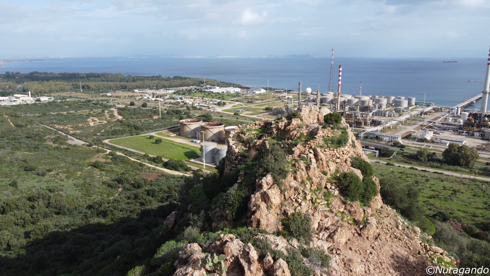
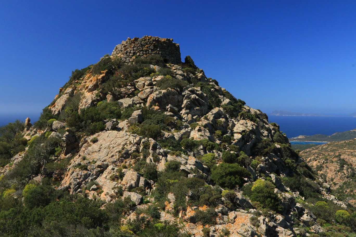
The Gulf of Cagliari, due to its strategic position and because its landings were sheltered from the prevailing northwesterly winds, must have played a strategic role in Mediterranean trade. It is interesting to note how numerous nuraghi rose along the coast or in its proximity, often visually connected to each other, located both along the southeastern stretch of coast (the over thirty nuraghi led by nuraghe Diana or Nuraxianna in the Capitana di Quartu area are an example) and along the southwestern coast. Among them, the nuraghe Sa Domu ‘e s’Orcu of Sarroch holds particular significance, described by Taramelli in 1926 in his “Quaderni di Scavi e Scoperte.” From the reissue of the writings of the great archaeologist, published by Carlo Delfino Editore in 1985 under the care of Alberto Moravetti, we have extracted the following excerpt:
<< For many years, the Directorate of Excavations in Sardinia, since it was entrusted to Professor Giovanni Patroni, had set its sights on nuraghe “Sa Domu ‘e s’Orcu” of Sarroch, both because it is relatively close to Cagliari and because it is located near the shore of the Gulf of this name, between the territories of the two ancient Phoenician-Punic colonies of Nora and Caralis, could hold the first traces of relations between the indigenous proto-Sardinians and the transmarine immigrants and provide some elements to illuminate the events of such relations and to establish whether they abruptly ended with the disappearance of nuragic civilization from the coastal area that saw the flourishing of the two rich Carthaginian maritime colonies. But other work attracted the Directorate’s efforts, and no progress could be made on the nuraghe of Sarroch until the enlightened courtesy of the landowner, Nob. Comm. Avv. Giuseppe Siotto broke the deadlock, as he not only granted permission to carry out the necessary excavations and research but also provided all possible assistance in the exploration campaign conducted in the spring of 1924, with means supplied by the Ministry of Education. Thus, I am pleased to express, first of all, the gratitude of our Directorate and scholars to the generous Mr. Siotto, to whom an example of a nuragic building explored with all the diligence that was possible is presented. The nuraghe “Sa Domu ‘e s’Orcu,” which stands on a hill a short distance from the sea, on the western side of the great Gulf of Cagliari, is not a solitary monument isolated from other nuragic buildings. The opinion that the southern part of the island lacks such constructions is not accurate, as remnants of many of them are preserved, despite the extensive destruction that has occurred in all periods. And the location of nuragic buildings is always in elevated positions dominating the nearby terrain, visible to one another, as in many other locations on the island, for careful vigilance of the land. But not only are numerous nuraghi noted throughout the southern part of the island, although generally more destroyed than in the central highlands, but by examining the coastline of the Gulf of Cagliari, a true chain of nuragic buildings presents itself, arranged at not great intervals from one another, at the mouths of the valleys or streams that descend from the mountains towards the sea. Sometimes these nuraghi are near the beach, sometimes somewhat distant, on the first slopes of the coastal chain, but always in sight of the sea, vigilant over the mouth of a valley, like advanced sentinels, and connected with a chain of other buildings that along the valley, on the slopes of the mountain, penetrate into the heart of the region. And this series of coastal guards, which precedes by a few millennia the belt of coastal towers of the Spanish-Savoyard type, has notable interest and value in confirming the opinions already expressed regarding the purpose of vigilant defense of the island for which the nuraghi were erected…>>.
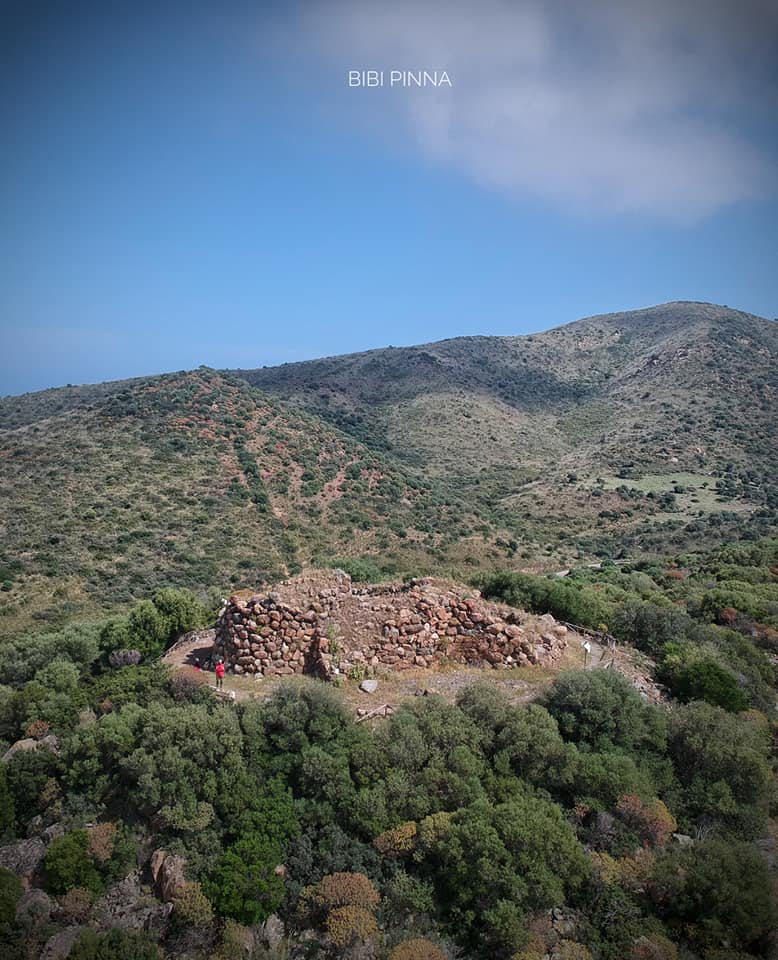
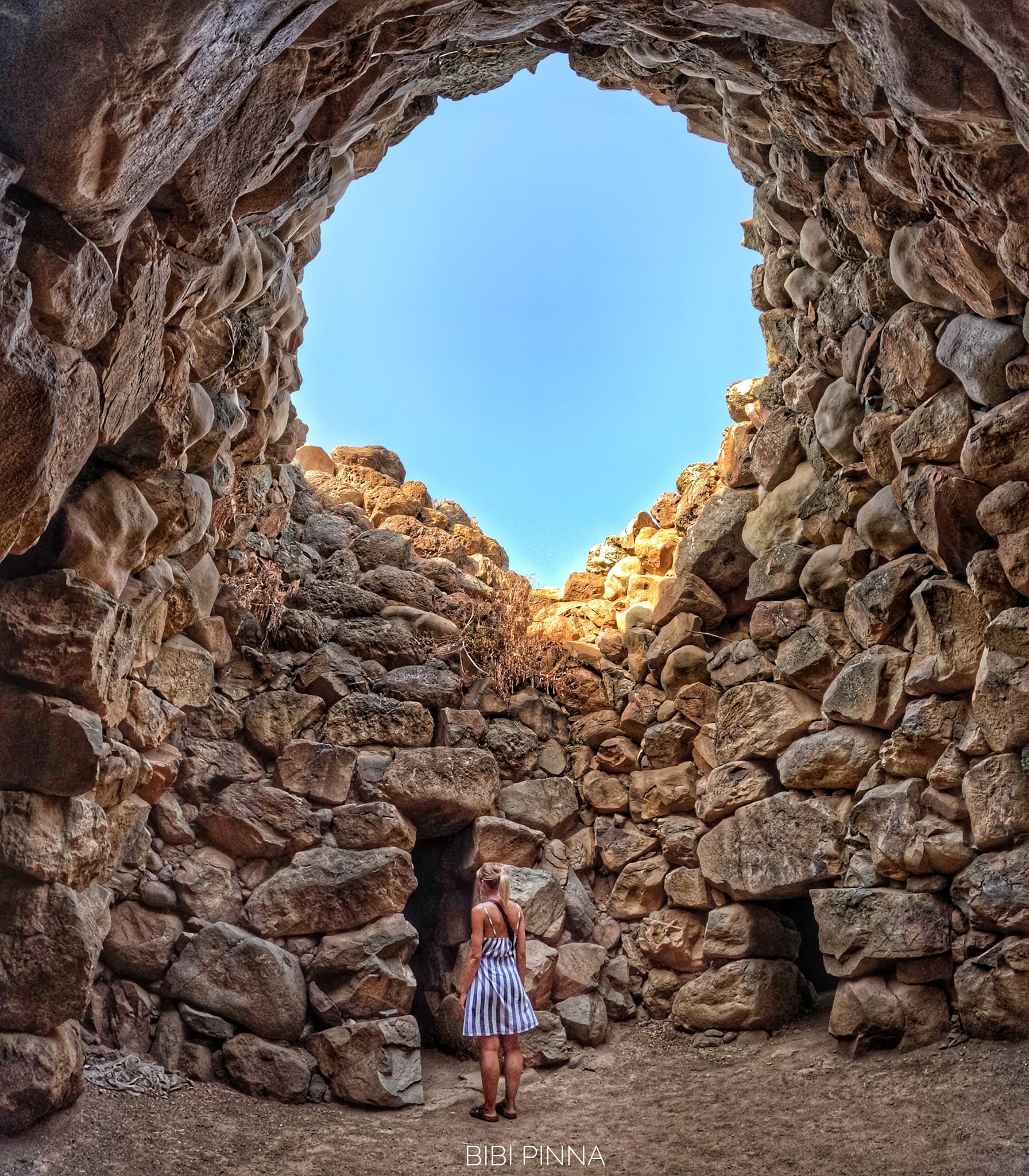
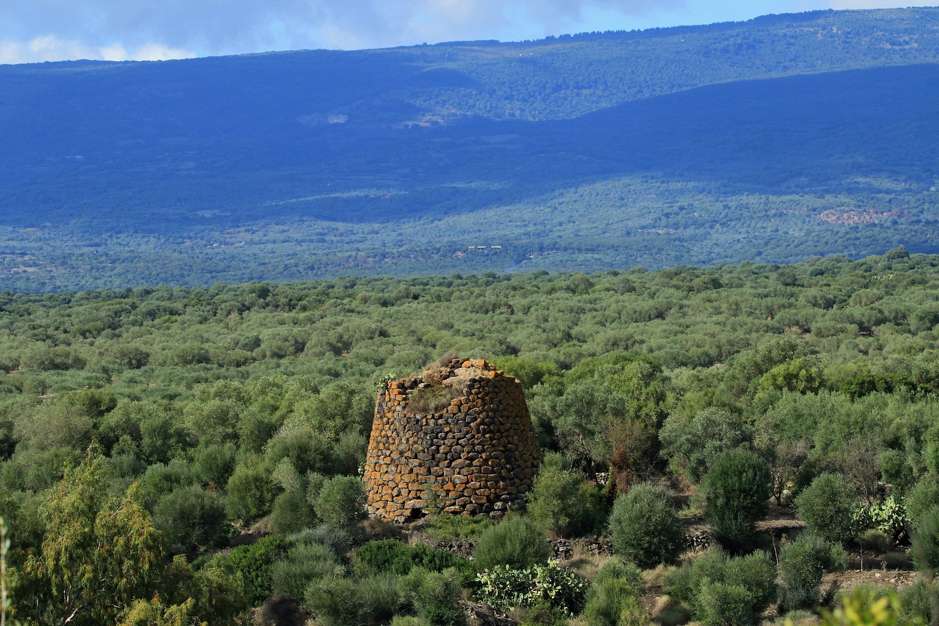
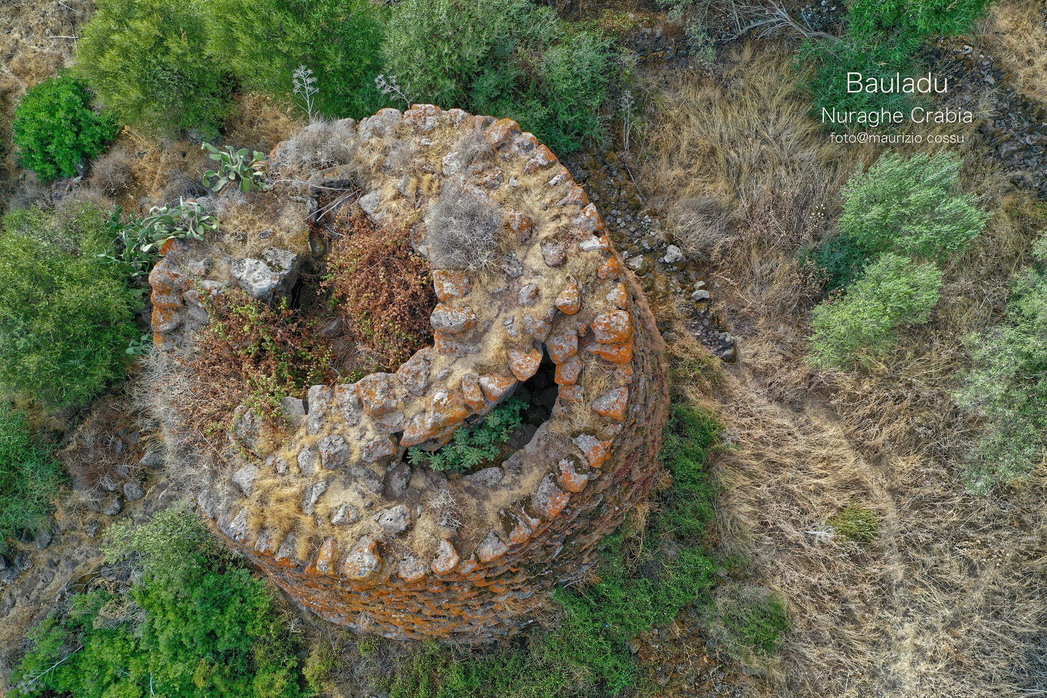
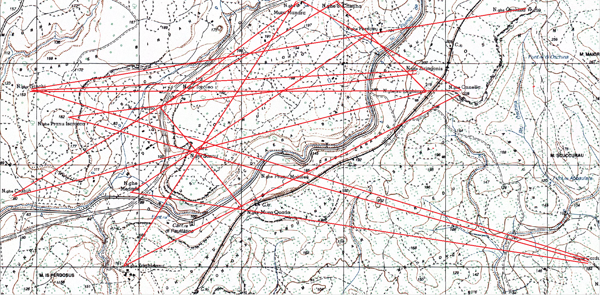
Attached: The nuraghi “Sa Domu ‘e S’Orcu” of Sarroch (ph. Bibi Pinna), “Crabia” of Bauladu (ph. Gianni Sirigu and Maurizio Cossu); “Diana” of Quartu Sant’Elena (ph. Nicola Castangia, Marco Cocco and Andrea Mura-Nuragando Sardegna); Panoramic view from the nuraghi “Antigori” of Sarroch (ph. Andrea Mura-Nuragando Sardegna and Marco Cocco) and “Riu Perdosu” of Teulada (ph. Gianni Sirigu, Alex Sardegna and Francesca Cossu); Excerpt from the IGM cartography highlighting some alignments between the nuraghi guarding the stretches of waterways included between the nuragic complex of “Santa Cristina” of Paulilatino and the nuraghe “Crabia” of Bauladu.