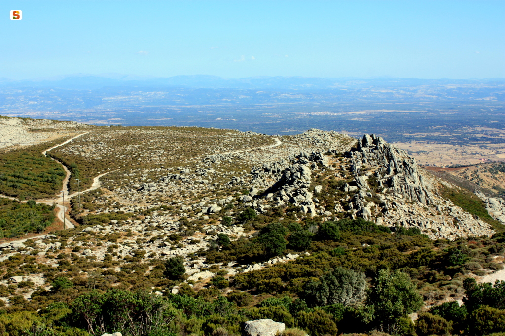
“This peak is called Monte Urticu, and since from there I could have seen many of my other signals placed on the different summits of the central part of the Island and knowing that on Monte Entu they would have remained hidden instead, it was precisely at that point that I set up a large signal, of which probably some remains still exist.
It is enough to say that from here I distinguished to the northwest the island of Asinara and to the southeast the tower of San Pancrazio in Cagliari and the peninsula of Sant’Elia; between this place and Asinara there is a distance that exceeds 108 kilometers in a straight line, while the tower of San Pancrazio is 120 kilometers away.”
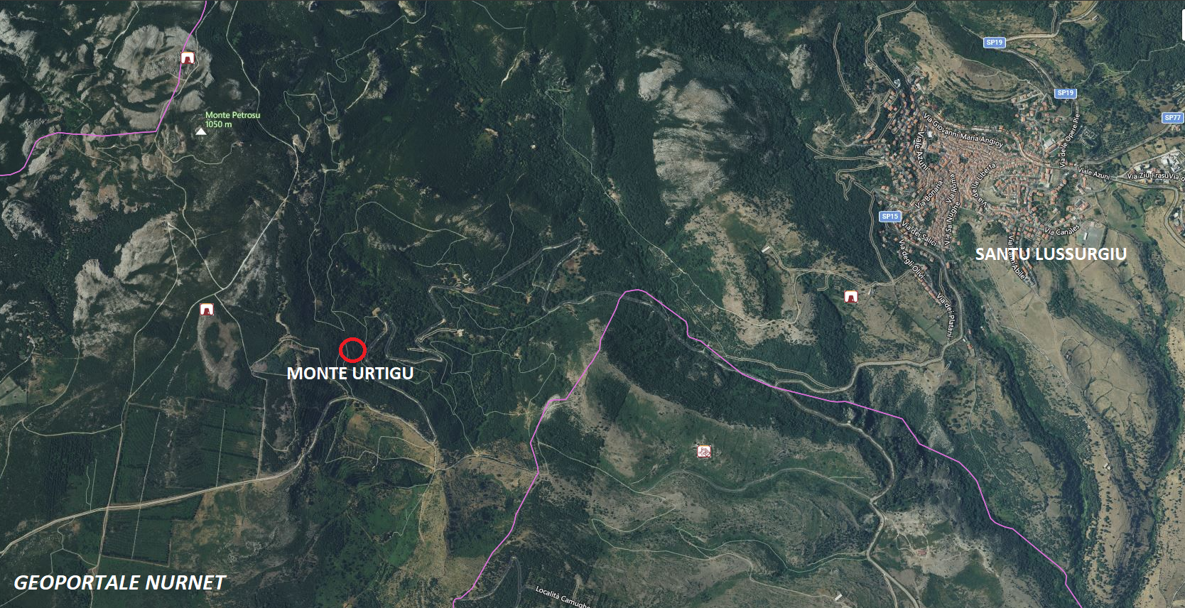
Thus wrote Alberto La Marmora in his “Voyage en Sardaigne,” after placing a trigonometrical signal on the summit of Monte Urtigu, the highest peak (1050 m.) of the Montiferru massif, which in turn extends about 700 square kilometers.
The presence of abundant springs, due in particular to the geological conformation of the mountain and the fissures that allow for the feeding of large underground basins and abundant aquifers, is certainly one of the reasons that had led to a strong anthropization of the territory since the Bronze Age, confirmed by the existence of an extraordinarily high number of nuraghi.
The presence of iron minerals could be another of the reasons that had caused the proliferation of human settlements, but this hypothesis still raises many questions and divides those who support and those who deny the hypothesis of the use of iron during the nuragic period.
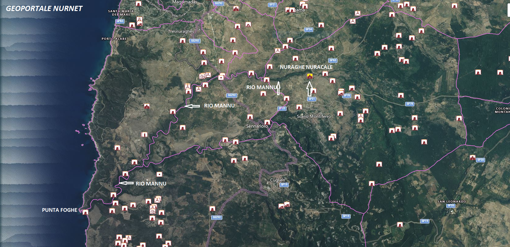
Not having specific expertise in this matter, I put an “x” and avoid expressing myself on the subject; however, I limit myself to observing the existence of a considerable number of nuraghi guarding various watercourses present in the territory, including the rio Mannu, which flows near Punta Foghe.
The attention given to this river suggests that at one time it was used for the transport of local productions to the embarkation point located at Punta Foghe, which was also guarded by a nuraghe.
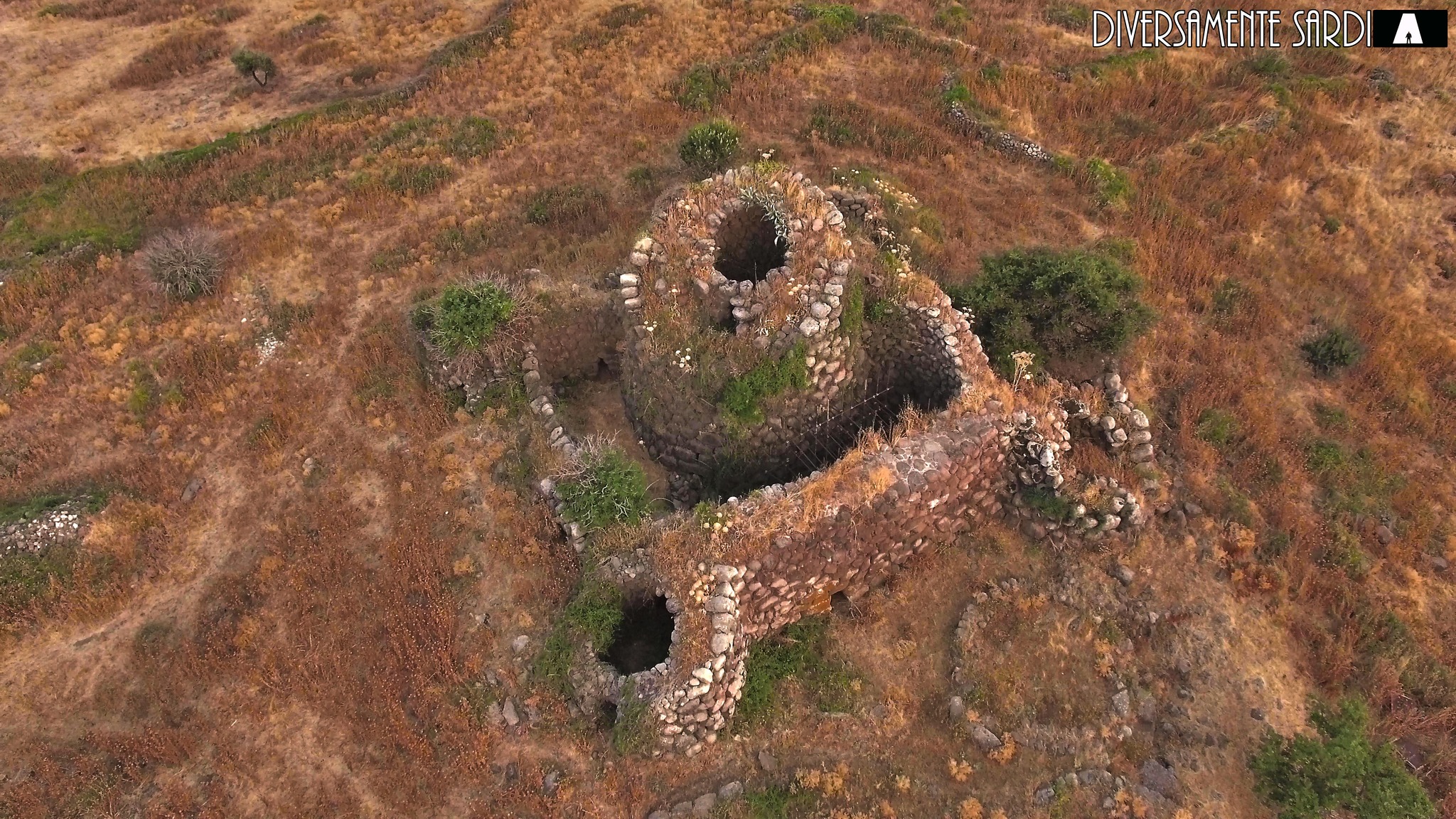
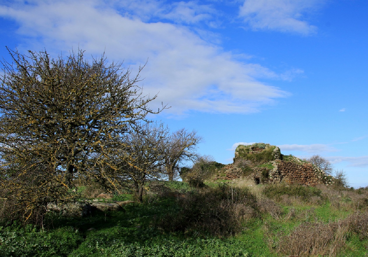
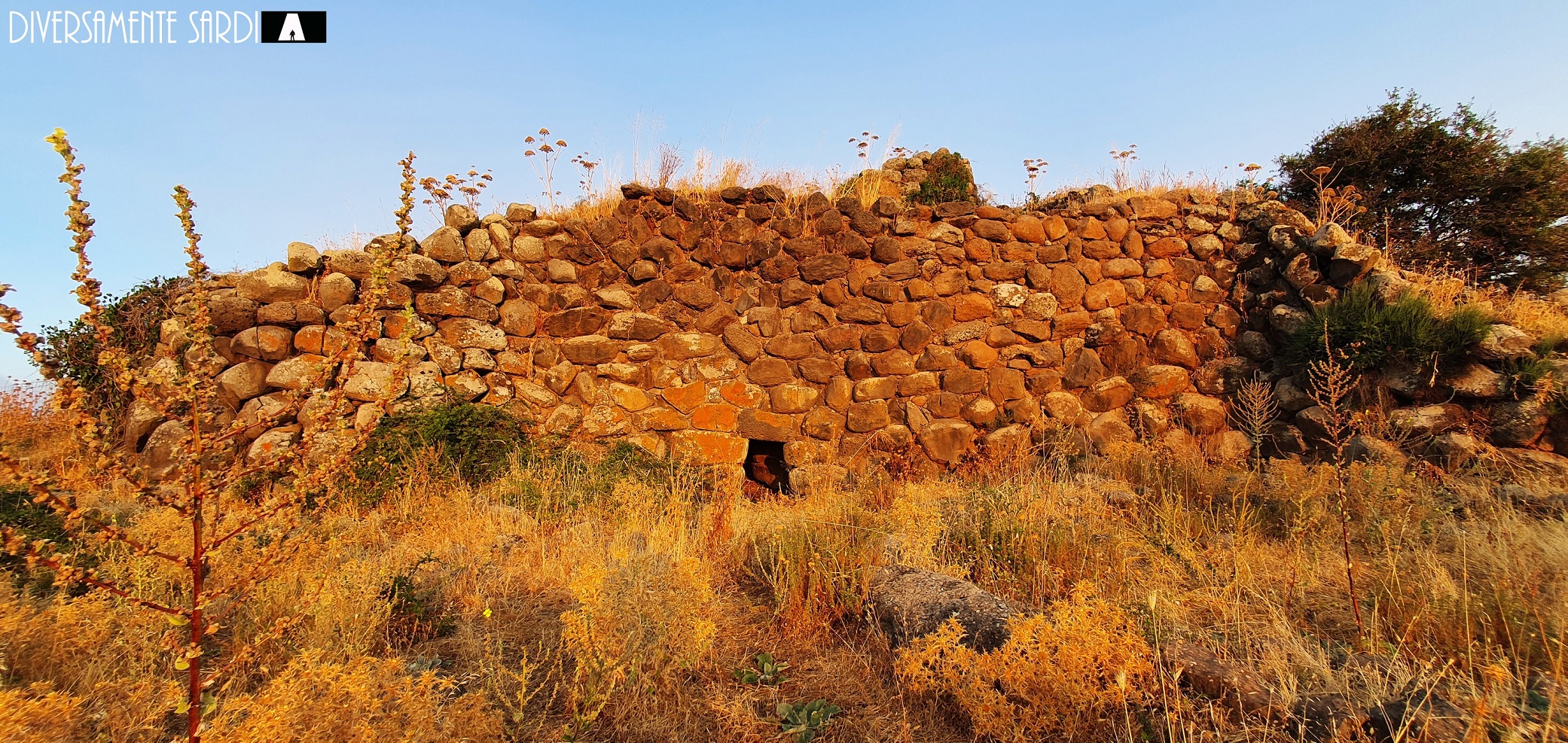
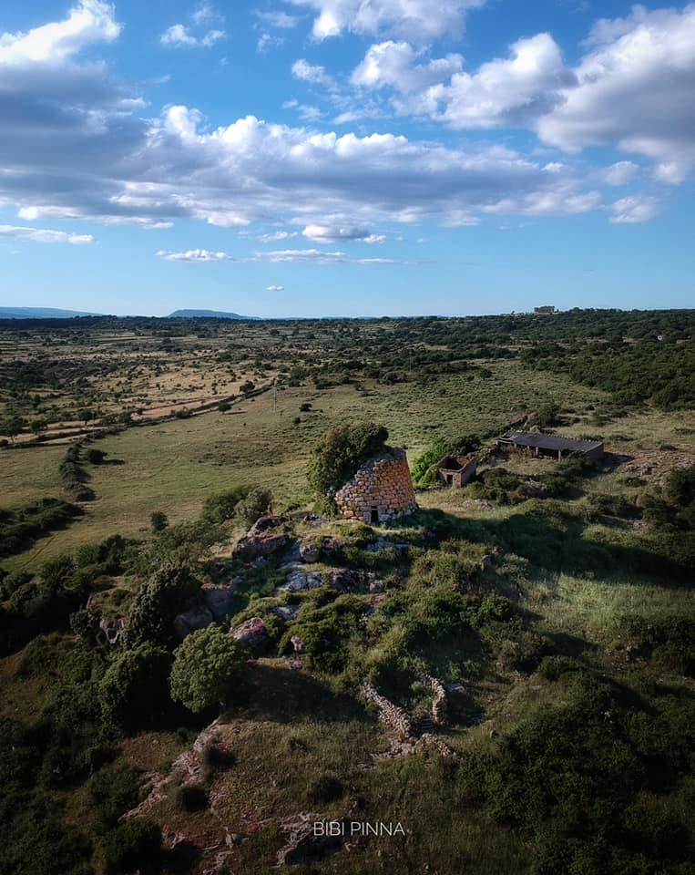
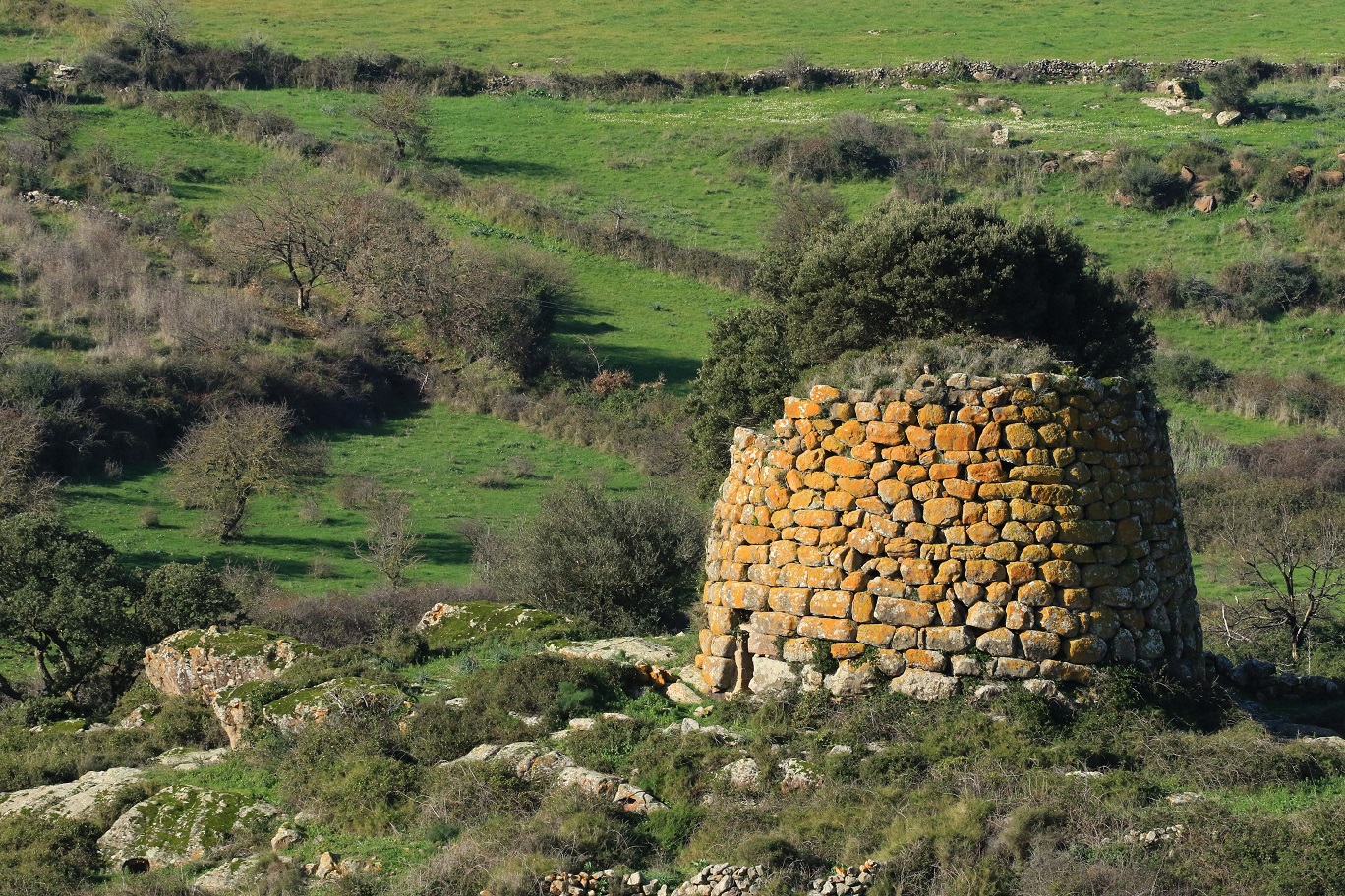
Among the many nuraghi, the Nuracale and Abbauddi of Scano Montiferro are perhaps the ones that most characterize the basin of the rio Mannu, but it is also true that in the compendium of Montiferru and in the surrounding territories, there are numerous nuragic structures, many of which are close to this watercourse, which in a distant past must have played a primary role in the territorial context.
The photos of the nuraghe Nuracale are by Diversamente Sardi and Gianni Sirigu. Those of the nuraghe Abbauddi are by Bibi Pinna and Gianni Sirigu. The panoramic photo taken from Monte Urtigu is from Sardegna Digital Library.”