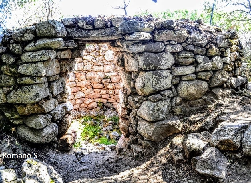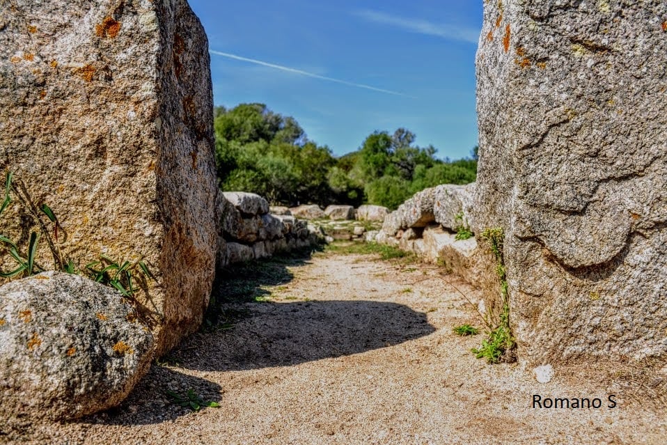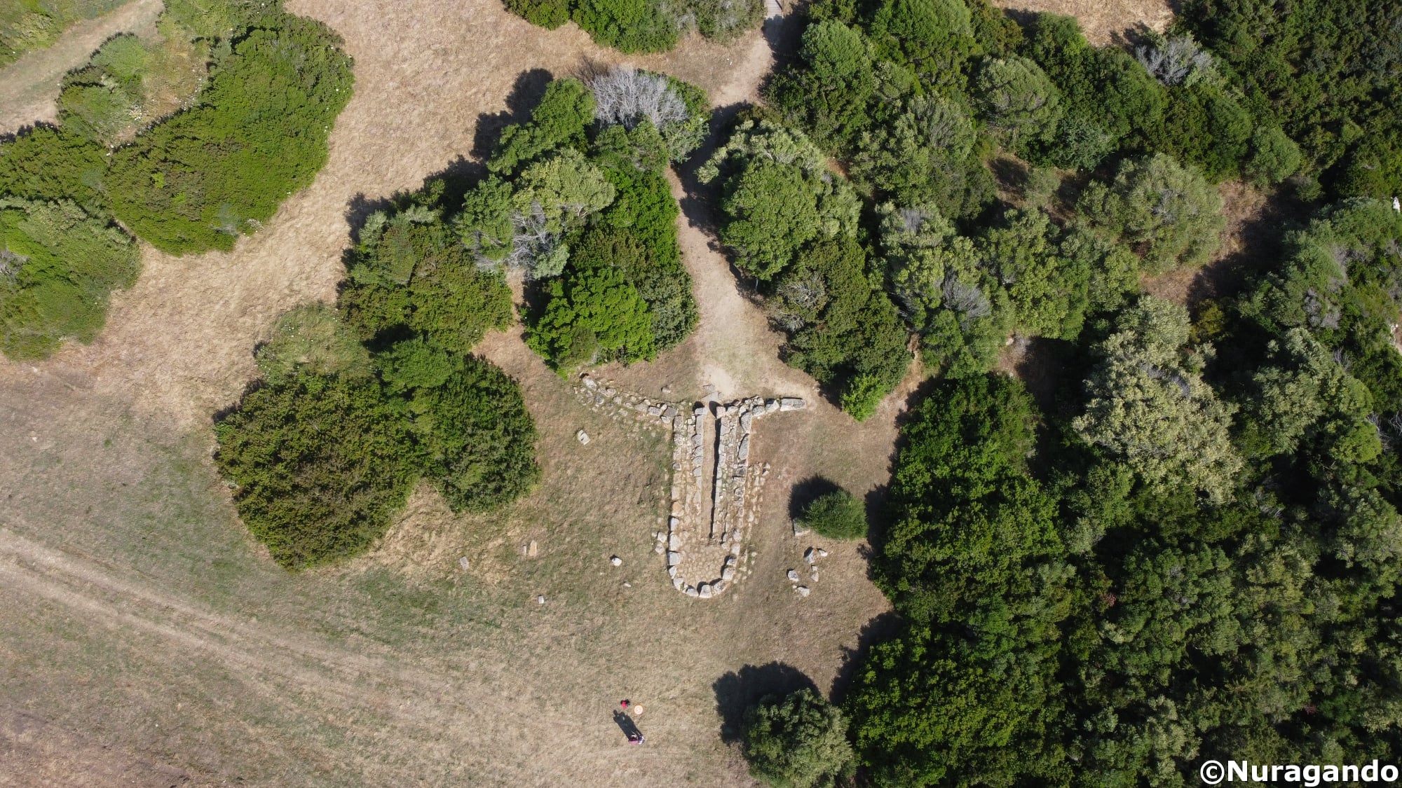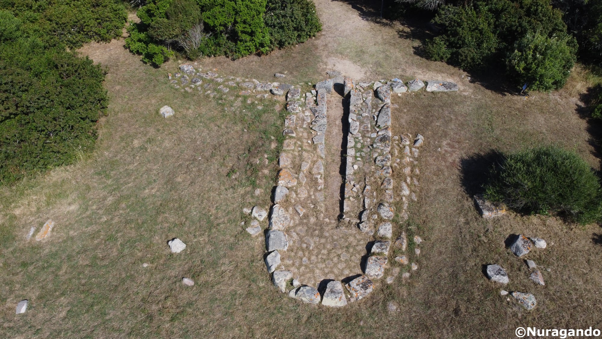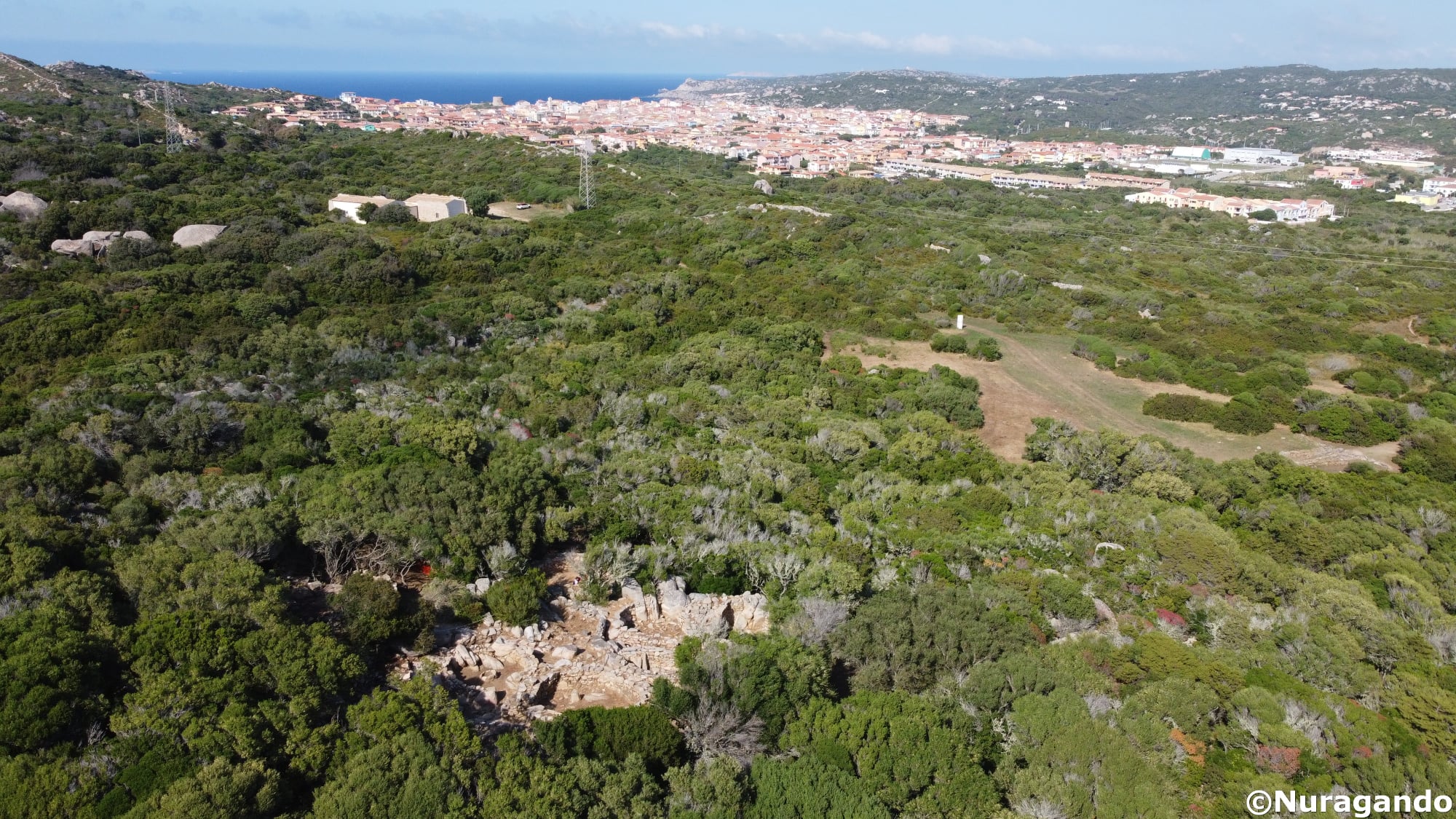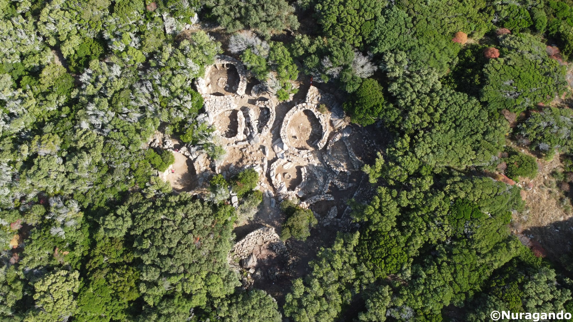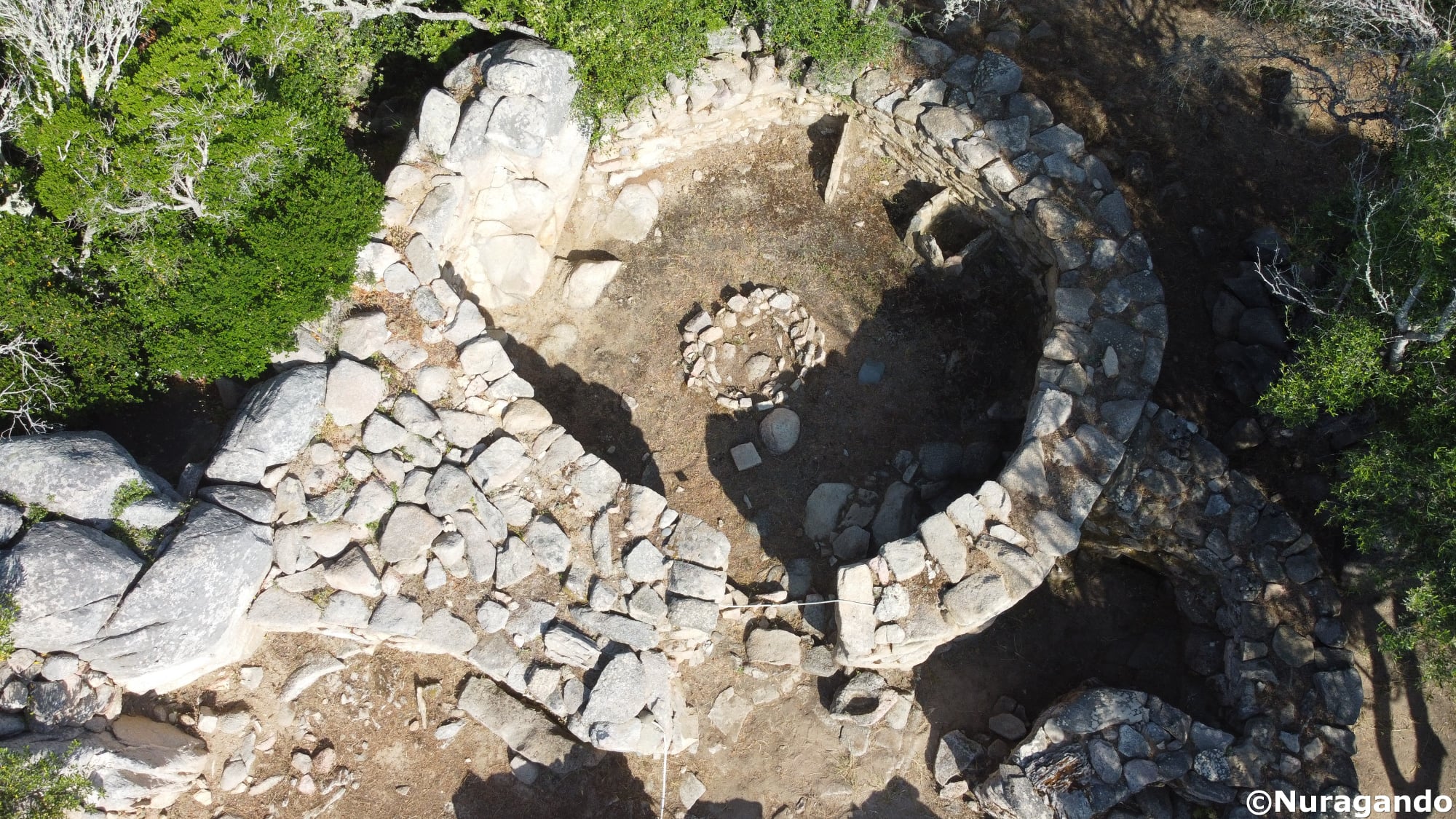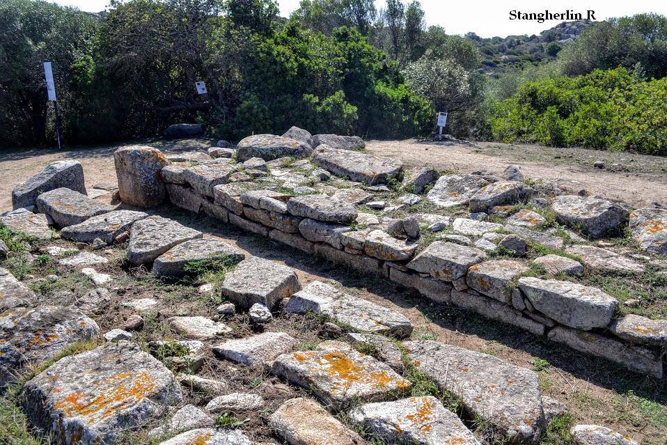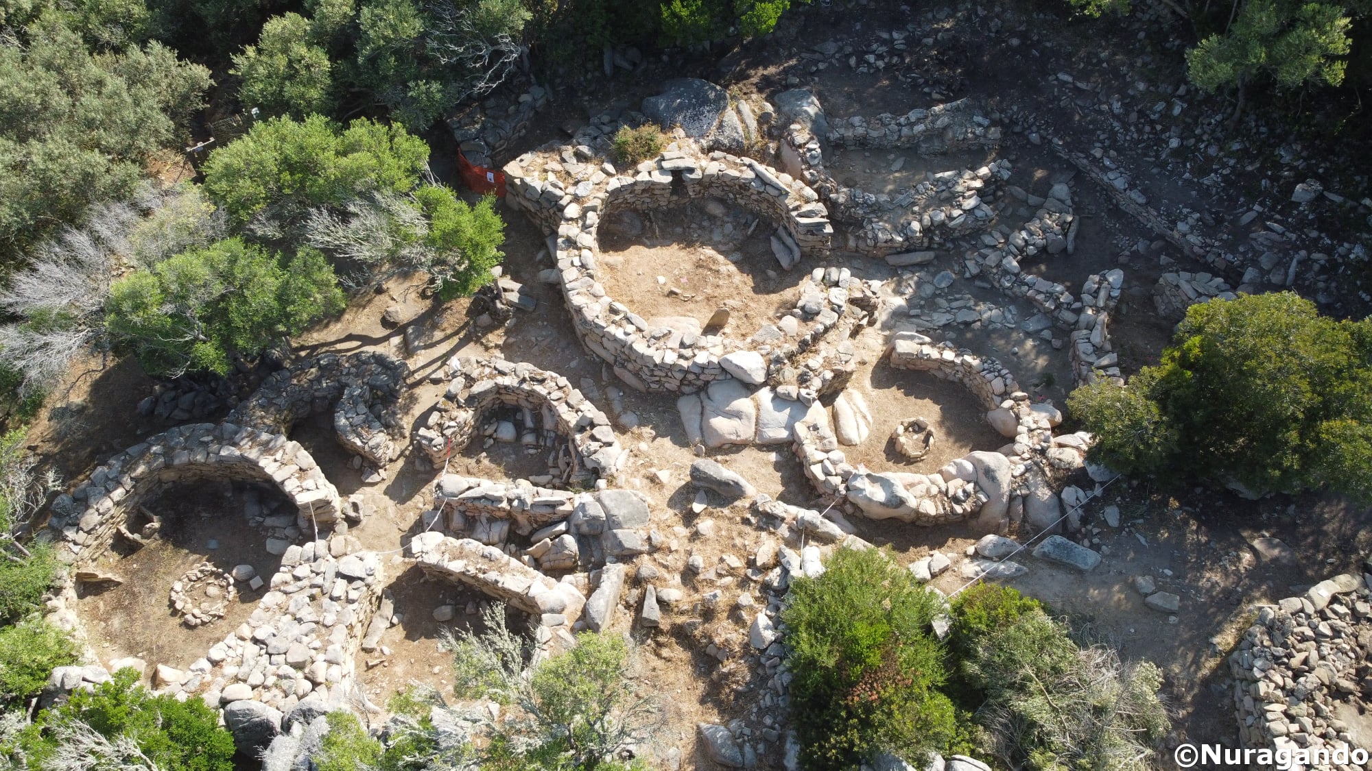
6a 2: The archaeological area of Lu Brandali, in Santa Teresa di Gallura, develops along the slopes of a granite promontory and the surrounding plain, near the bay of Santa Reparata, on the northern coast of Gallura. The complex includes a nuraghe with antemurale, a village, a giant’s tomb, tafoni, and rock shelters. The nuraghe, positioned at the highest elevation, utilizes the rocky levels to develop on staggered levels. The village, which in 1967 had 36 huts, is now only partially visible and extends along the slope and in the plain to the east and south of the nuraghe. The huts, generally curvilinear, adapt to the rocky morphology, often incorporating outcrops, and feature double stone walls; the blocks, either roughly hewn or unrefined, are arranged in regular rows and bound with mud mortar. The conical roofs were supported by a framework of beams and smaller beams to which other crosswise wooden elements were tied. These supported a thatched roof of bundles of marsh reeds converging towards the center and covered with a layer of clay mortar that ensured insulation. Other bundles of vegetation were then placed on top, secured by small limestone slabs. The giant’s tomb, of which only the foundations remain, is located southeast of the village, at the edge of the slope. Once majestic, it consists of an elongated tomb structure with an apse-shaped termination and a semicircular exedra. The masonry was probably built in rows. About 60 km southeast is a circular structure possibly linked to the ritual that preceded the burial in the giant’s tomb. The tafoni and caves that open in the granite boulders on the western and southwestern slopes of the promontory were used during the nuragic period as shelters and dwellings, as well as places of burial.
The photos of the nuragic complex of Lu Brandali, in the territory of Santa Teresa di Gallura, are by Romano Stangherlin and Andrea Mura – Nuragando Sardegna.